There are two ways to search for smoky mountains scenic drives online. One gives you the same five recycled lists with the same generic descriptions. This is the other one.
We have spent over 5 years in Pigeon Forge, Tennessee putting riders on these exact roads in street-legal UTVs with our private maps, and we have learned things about these routes that do not show up in a typical travel blog. With 500+ five-star reviews and thousands of renters guided through these mountains, this is what we know.
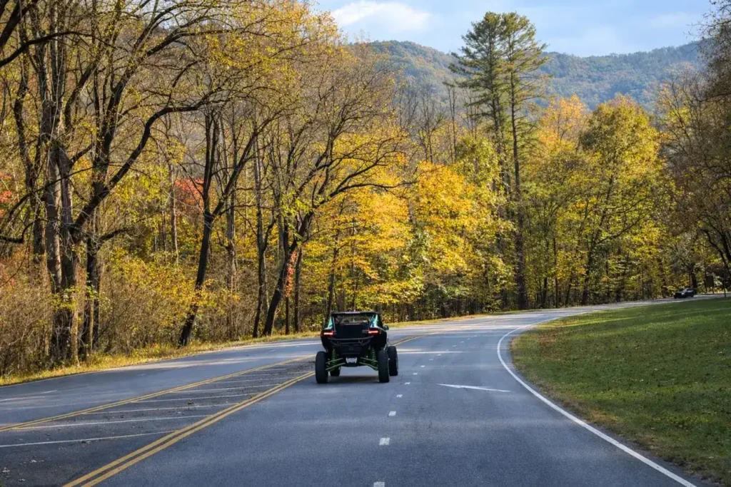
8 scenic drives in the Great Smoky Mountains with real distances, honest timing, and insider tips from people who drive these roads every week. We also cover the two comparisons we get asked about most: Foothills Parkway versus Newfound Gap, and Cades Cove versus Roaring Fork.
Table of Contents
Quick Reference: All 8 Scenic Drives at a Glance
| Drive | Distance | Best For | UTV-Friendly? |
|---|---|---|---|
| Newfound Gap Road (US-441) | 33 mi one way | First-timers, big elevation views | ✅ Yes |
| Cades Cove Loop | 11 mi loop | Wildlife, historic buildings | ✅ Yes |
| Little River Road | 25 mi | River scenery, waterfalls | ✅ Yes |
| Roaring Fork Motor Trail | 5.5 mi loop | Old-growth forest, cabins | ✅ Yes |
| Kuwohi Road (formerly Clingmans Dome) | 7 mi one way | Highest peak, 360° views | ✅ Yes |
| Foothills Parkway | 33 mi | Ridge views, fewer crowds | ✅ Yes |
| Rich Mountain Road | 10 mi | Isolated gravel back road | ✅ Yes |
| Cataloochee Valley Road | 7.3 mi | Elk viewing, solitude | ⚠️ Partially |
Good to know before you go: Great Smoky Mountains National Park has no entrance fee, but a parking tag is required if you stop for more than 15 minutes. $5 daily / $15 weekly / $40 annual. Tags available at recreation.gov or at automated kiosks throughout the park. Every UTV rental includes a National Park parking pass.
The 5 Classic Scenic Drives in the Smoky Mountains
These are the must-do routes for any scenic drive through the Smokies. Whether it is your first time or your fifth, these five deliver every time.
1. Newfound Gap Road (US-441): The One That Crosses the Entire Park
- Distance: 33 miles one way (Gatlinburg to Cherokee, NC)
- Drive time: About 1 hour nonstop, but plan for 3+ hours with stops
- UTV-friendly: Yes. paved public road, speed limit 35 MPH
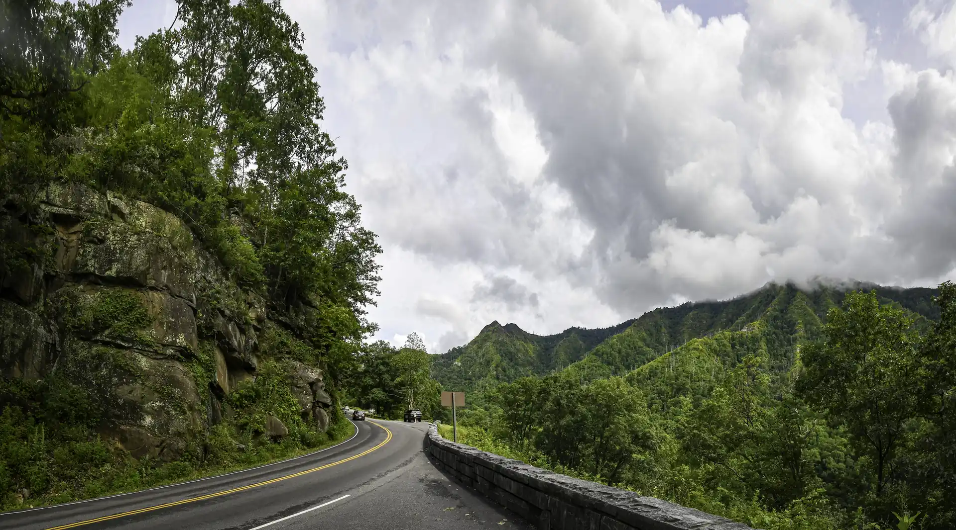
Newfound Gap Road cuts straight through the heart of Great Smoky Mountains National Park, climbing from just under 1,300 feet in Gatlinburg to 5,046 feet at Newfound Gap. That elevation change is real. Your ears will pop, the temperature drops 10-15 degrees, and the forest shifts from hardwoods to spruce-fir the higher you go.
Key stops worth pulling over for:
- Campbell Overlook (about 2 miles south of Sugarlands Visitor Center). First major viewpoint heading south. Good morning light for photos, with views of Mt. LeConte at 6,593 feet.
- Chimney Tops Overlook: One of the best quick pull-offs on the entire road. You can see the twin rock spires without hiking.
- Newfound Gap: The Tennessee-North Carolina state line at 5,046 feet. The Rockefeller Memorial is here, and on a clear day you can see for miles in every direction.
- Oconaluftee Valley: The southern end drops into elk country. Early morning (before 8 AM) is when you’re most likely to see them grazing.
Insider tip: Drive this one early. By 10 AM on any summer weekend, the Newfound Gap parking lot is full and the road moves slow. Hit it at 7 AM and you’ll have overlooks mostly to yourself. The light is better that early anyway.
Seasonal note: This road stays open year-round, though temporary closures happen during ice and snow events.
2. Cades Cove Loop: The Most Popular Drive in the Park
- Distance: 11-mile one-way loop
- Drive time: About 2 hours, but in peak season it can stretch to 4+ hours
- UTV-friendly: Yes. paved loop road, speed limit 20 MPH
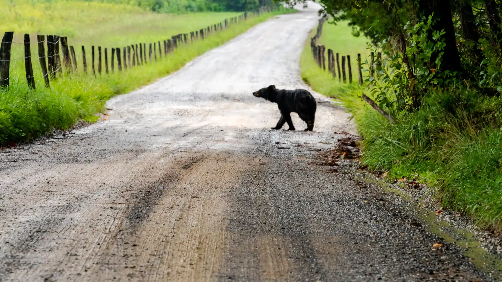
Cades Cove is the single most visited spot in the national park. The wide valley framed by mountains is unlike anything else in the Smokies. Historic homesteads, churches, and log cabins dot the loop, and the wildlife viewing is as good as it gets east of the Mississippi.
What you’ll actually see:
- Black bears: Cades Cove has one of the densest black bear populations in the eastern US. Sightings are common, especially in spring and fall.
- White-tailed deer and wild turkeys: Almost guaranteed, particularly at dawn and dusk.
- Historic structures: John Oliver Cabin, Primitive Baptist Church, Cable Mill area (the busiest stop, and worth it).
Insider tip: The loop is one-way, and once you’re on it, you’re committed. There are two cutoff roads (Sparks Lane and Hyatt Lane) that let you skip sections, but there’s no turning around. If you want to avoid the bumper-to-bumper crawl, go before 10 AM or after 5 PM. The light at golden hour in Cades Cove is some of the best photography in the entire park.
Also worth knowing: From early May through late September, the loop is closed to motor vehicles all day on Wednesdays for cyclists and pedestrians. Plan around it, or bring bikes.
3. Little River Road: The Underrated Scenic Drive Along the Water
- Distance: 25 miles (Sugarlands Visitor Center to Townsend)
- Drive time: About 45 minutes nonstop, but allow 1.5-2 hours
- UTV-friendly: Yes. paved two-lane road, follows the river the entire way
This one doesn’t make as many “best of” lists, and that’s exactly why we like it. Little River Road follows the Little River from Gatlinburg all the way to the western side of the park near Townsend. It’s one of the most relaxing scenic drives in the Smoky Mountains because the road runs right alongside the water almost the entire way.
Key stops:
- The Sinks: A waterfall and swimming hole about halfway through. The river drops over a ledge and carves into a deep pool. Easy to find, small parking area that fills up fast.
- Metcalf Bottoms: Picnic area with river access. Good for a quick stretch or wading.
- Laurel Falls Trailhead: One of the most popular hikes in the park (2.6 miles round trip to an 80-foot waterfall). Note: The trail is currently closed for a major rehabilitation project and is expected to reopen in summer 2026. Check nps.gov for updates.
Insider tip: There are a dozen unmarked pull-offs along this road where you can park and walk right down to the river. These are the spots most visitors drive past without noticing. In a UTV, pulling over is easy. No worrying about fitting into a tight spot.
4. Roaring Fork Motor Trail: A Short Loop with Big Payoff
- Distance: 5.5 miles (one-way loop)
- Drive time: 30-45 minutes
- UTV-friendly: Yes. paved, low speed, one-way
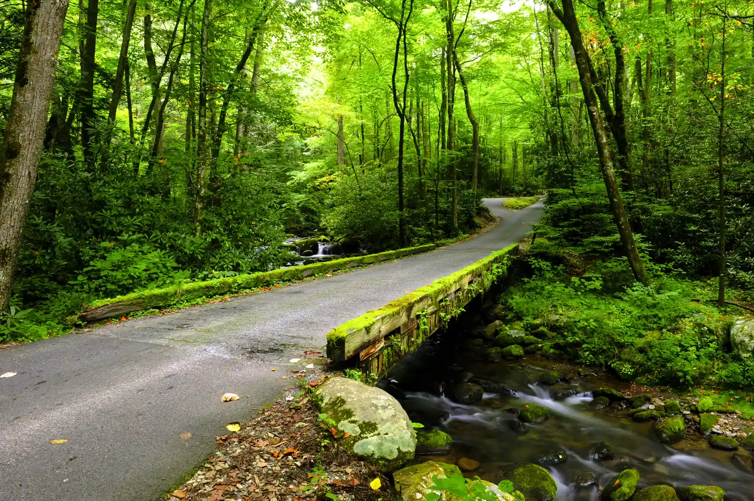
This short loop near Gatlinburg packs a lot into 5.5 miles. It’s a one-way road through old-growth forest, past historic cabins and homesteads, with waterfall trailheads along the way. The forest canopy closes over the road in sections, and in summer the green is almost overwhelming.
What makes it worth it:
- Old-growth trees: Some of the largest tulip poplars and hemlocks in the park are along this road.
- Ephraim Bales Homestead: A preserved cabin and farm site. Quick walk from the road.
- Trillium Gap Trail: This is the trailhead for Grotto Falls, where you can walk behind the waterfall. The hike is about 2.6 miles round trip. Note: only accessible when Roaring Fork Motor Trail is open.
Insider tip: The road itself is narrow with tight curves and no shoulders. It’s not the place for speed. It’s the place for slow, open-air driving. In fall, the canopy turns the whole thing into a tunnel of color.
Important: Roaring Fork Motor Trail is now open for the 2026 season (opened early, ahead of the scheduled May 1 date) and closes at the end of November.
5. Kuwohi Road (formerly Clingmans Dome Road): The Highest Point in the Smokies
- Distance: 7 miles one way (from Newfound Gap Road)
- Drive time: 15-20 minutes each way, plus time at the top
- UTV-friendly: Yes. paved, but steep with switchbacks
Kuwohi, renamed from Clingmans Dome in 2024 to restore the original Cherokee name meaning “mulberry place”, is the highest point in Great Smoky Mountains National Park at 6,643 feet. The road branches off Newfound Gap Road and climbs steadily to a parking area, from which it’s a steep half-mile walk up to the observation tower.
What you’ll find at the top:
- 360-degree views from the concrete observation tower. On a clear day, visibility can reach 100 miles.
- Spruce-fir forest: This ecosystem only exists at high elevations in the southern Appalachians. It feels more like Canada than Tennessee.
- Appalachian Trail crossing: The AT passes right through the parking area. Kuwohi is the highest point along the trail’s entire 2,190+ mile route.
Insider tip: Clouds and fog roll in fast up here. Morning tends to offer the clearest skies. If you arrive and it’s socked in, give it 20-30 minutes. The fog can break quickly. Also, it’s typically 10-20 degrees cooler than Gatlinburg, so bring a layer even in summer.
Important: Kuwohi Road is closed from December 1 through March 31. The parking lot fills early on weekends. Aim for arrival before 9 AM.
3 Hidden Scenic Drives Near Pigeon Forge and Gatlinburg
These next three routes don’t show up on every list, but they’re the ones we keep coming back to. If you’ve already done the classics, these drives show you a completely different side of the Smokies.
6. Foothills Parkway: The Ridge Drive with the Fewest Crowds
- Distance: 33 miles (western section, Chilhowee to Wears Valley)
- Drive time: About an hour without stops
- UTV-friendly: Yes. paved scenic highway.
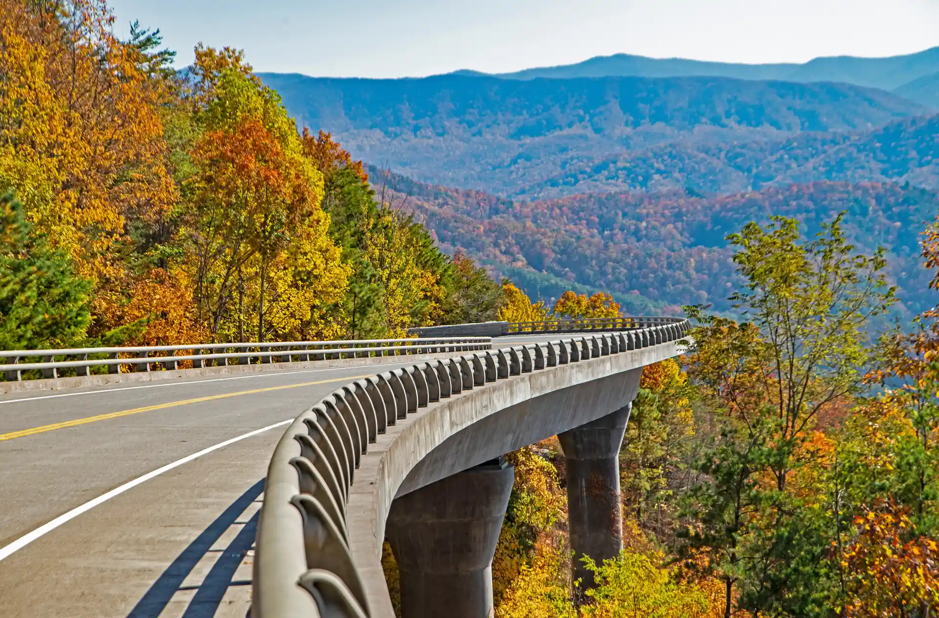
The Foothills Parkway runs along the northern boundary of the park, and the views are completely different from anything inside the park itself. Instead of being surrounded by forest, you’re riding a ridgeline with long-distance views of the Smokies to the south and the Tennessee Valley to the north.
Why we send people here:
- Far fewer crowds than Newfound Gap or Cades Cove
- Dramatic overlooks with big, open views. Great for photos
- The “Missing Link” section (completed in 2018 after decades of construction) includes nine bridges that curve over deep valleys. Some of the most impressive engineering in the region.
Insider tip: Combine Foothills Parkway with a run through Townsend and back to Pigeon Forge for a solid half-day loop. This is actually one of our mapped routes, the Half-Day Foothills Loop, and it pairs big ridge views with waterfall stops on the back half.
7. Rich Mountain Road: The Back Way Out of Cades Cove
- Distance: About 10 miles (one-way, Cades Cove to Townsend)
- Drive time: 45 minutes to an hour (gravel, slow going)
- UTV-friendly: Yes, but seasonal. The road typically opens around mid-April.
Including this one because it absolutely deserves the mention. Rich Mountain Road is the back way out of Cades Cove. It’s a winding, unpaved, one-way road that climbs over Rich Mountain with some of the most isolated views in the park. You won’t see another car for long stretches.
Worth knowing: The road is rough, narrow, and has no guardrails in places. It’s closed in winter and during wet weather. No trailers or RVs. Because it’s a seasonal road, always check the NPS seasonal roads page before heading out. If you have a vehicle with decent clearance, it’s a memorable drive, but it’s not for everyone.
8. Cataloochee Valley Road: The Best Drive for Elk in the Smokies
- Distance: 7.3 miles into the valley (from I-40)
- Drive time: About 45 minutes from I-40 to the valley floor (the approach is slow)
- UTV-friendly: Partially. the main paved roads are fine, but the gravel entrance road is narrow and rough in spots
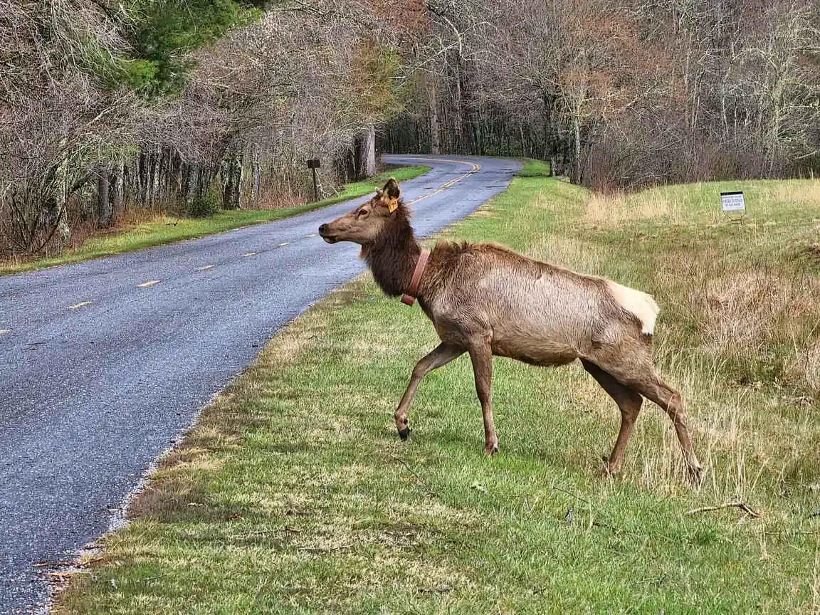
Cataloochee is where the park reintroduced elk in 2001, and it remains one of the best places in the eastern US to see them. The valley is remote, about 45 minutes of winding road from I-40, and that remoteness keeps the crowds away.
Important update: Hurricane Helene caused significant damage to the Cataloochee area in late 2024, and some trails and roads have been partially closed for repairs. Check the NPS website for current conditions before making the drive out.
What you’ll find:
- Elk herds: Best viewing is early morning or late evening, especially in the fall when bulls are bugling during the rut. September and October are prime time.
- Historic buildings: Palmer Chapel, Beech Grove School, several preserved homesteads.
- Solitude: On a weekday, you might have the valley nearly to yourself.
Insider tip: The drive in is long and slow, but that’s part of the appeal. Cell service disappears early. Pack a lunch, bring binoculars, and plan for at least a half day. Fall evenings here, listening to elk bugle across the valley, are some of the most memorable moments the Smokies have to offer.
Foothills Parkway vs Newfound Gap: Which Scenic Drive Should You Do?
This is the question we get most from people who only have time for one big drive. Here is the honest answer.
| Foothills Parkway | Newfound Gap Road | |
|---|---|---|
| Distance | 33 miles | 33 miles one way |
| Drive time | 1 hour+ | 3+ hours with stops |
| Views | Open ridge, Tennessee Valley | Elevation change, forested canyon |
| Crowds | Low | High in peak season |
| UTV-friendly | Yes | Yes |
| Season | Year-round | Year-round |
| Best for | Photos, open views, relaxed pace | Full park experience, elevation |
The short answer: if you want the classic Great Smoky Mountains National Park scenic drive experience with elevation change and the feeling of crossing a mountain, do Newfound Gap Road. If you want dramatic open views with almost no traffic and a completely different perspective, do the Foothills Parkway. Ideally, do both. They connect easily into a half-day loop through Townsend.
Cades Cove vs Roaring Fork: Which Loop Is Worth Your Time?
Both are loops near Gatlinburg. Both deliver on scenery. But they are very different experiences.
| Cades Cove Loop | Roaring Fork Motor Trail | |
|---|---|---|
| Distance | 11 miles | 5.5 miles |
| Drive time | 2 to 4+ hours | 30 to 45 minutes |
| Crowds | Very high in peak season | Moderate |
| Wildlife | Excellent (bears, deer, turkey) | Limited |
| Historic sites | Many (cabins, churches, mill) | A few (homesteads) |
| Waterfalls | No | Yes (Grotto Falls trailhead) |
| Forest | Open valley | Closed canopy, old-growth |
| Closed | Wednesdays in season (bikes only) | Late November through spring |
The short answer: if you have kids or want wildlife and history, do Cades Cove. If you want old-growth forest, a shorter commitment, and waterfall access, do Roaring Fork. If you have most of a day, do both.
Planning Tips for Smoky Mountain Scenic Drives
A few things we’ve learned from years of sending people out on these roads:
Go early. Seriously. The difference between arriving at Cades Cove at 7 AM versus 11 AM is the difference between a peaceful valley drive and sitting in a traffic jam behind someone who stopped in the road to photograph a turkey. Most major parking lots fill by mid-morning in peak season.
Weekdays are dramatically less crowded. If you have any flexibility at all, a Tuesday or Wednesday drive will feel like a completely different park than a Saturday.
Check seasonal road closures before you go. Several roads close for winter:
- Kuwohi Road: December 1 – March 31
- Roaring Fork Motor Trail: Now open / closes end of November
- Rich Mountain Road: Closed in winter and wet weather
- Balsam Mountain Road: Opens May 15, 2026 for the season
Cades Cove Loop and Newfound Gap Road stay open year-round but may close temporarily during severe weather.
Cell service is unreliable. Once you’re inside the park, expect spotty to zero coverage on most carriers. Download offline maps before you go, or better yet, have a physical map or printed route. Our renters get detailed private maps for exactly this reason. We’ve marked the stops, pull-offs, and turns so you don’t need to rely on your phone.
Pack layers. Elevation changes mean temperature swings. It can be 85°F in Gatlinburg and 65°F at Kuwohi on the same afternoon.
Bring water, snacks, and a full tank of gas. There are no gas stations, restaurants, or convenience stores inside the park. Once you’re in, you’re in.
Why These Drives Are Better in a Street Legal UTV
There’s nothing wrong with exploring these roads in a car. People have been doing it for decades and loving every mile.
But there’s a reason our renters keep saying the UTV drive was the highlight of their trip.

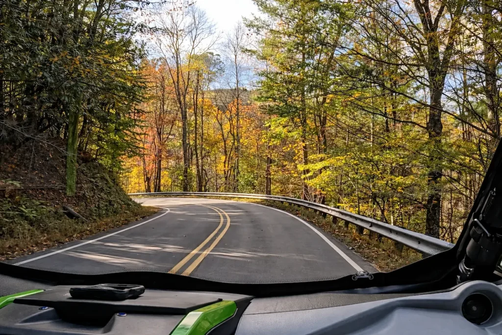
In a street legal UTV, you’re not watching the Smokies through a windshield. You’re in them. The air hits you. You hear the rivers before you see them. You can pull over at any unmarked gravel pull-off without worrying about blocking traffic, snap a photo, and be back on the road in 30 seconds.
Our fleet includes current-model Polaris RZR, Can-Am, Honda, Kawasaki, Yamaha side-by-sides in 2, 4, and 6-seat configurations, including enclosed cabins with climate control for year-round comfort. Every rental comes with private maps we’ve built over 5+ years of exploring these mountains. The maps don’t just show you the main overlooks. they show you the pull-offs that don’t have names and the timing to avoid crowds at every stop.
Ready to experience them with the open-air freedom of a UTV? Our UTV rentals in Pigeon Forge come with the machine, the maps, and everything you need to make these drives the best part of your trip.
Frequently Asked Questions About Smoky Mountain Scenic Drives
What is the most scenic drive in the Smoky Mountains?
Newfound Gap Road (US-441) is widely considered the most scenic drive in Great Smoky Mountains National Park. It crosses the entire park from Gatlinburg, Tennessee to Cherokee, North Carolina, climbing from about 1,300 feet to 5,046 feet at Newfound Gap. The elevation change, the forest transition from hardwoods to spruce-fir, and the views at the top make it the most complete scenic drive in the Smokies. For wildlife and historic character, Cades Cove Loop is the other essential drive.
Can you drive through Smoky Mountain National Park?
Yes. Great Smoky Mountains National Park has several roads open to private vehicles year-round, including Newfound Gap Road (US-441), which crosses the entire park from Gatlinburg, Tennessee to Cherokee, North Carolina. Some roads are seasonal: Kuwohi Road closes December 1 through March 31, and Roaring Fork Motor Trail closes in late November. The park has no entrance fee, but a parking tag ($5 daily) is required if you stop for more than 15 minutes.
What are the best Smoky Mountain scenic drives for summer in Tennessee?
Summer is ideal for Newfound Gap Road (elevation keeps it cooler than the valley), Little River Road (river access and swimming holes), and the Foothills Parkway (open ridge views with far fewer crowds than main park roads). Cades Cove is best before 10 AM in summer to beat the heat and traffic. If you are planning a smoky mountains road trip from Pigeon Forge or Gatlinburg, combining Newfound Gap as the main drive with Little River Road as the return route covers most of what the park offers in a single day.
Is there a scenic drive map for the Smoky Mountains?
The National Park Service publishes a free park map at visitor centers and at nps.gov. For the drives in this guide, we go further. When you pick up your rental at Smoky Mountain Adventure Rides, our team walks you through the routes before you head out: the stops, the timing, and the hidden spots most visitors drive right past. Our maps cover all 8 routes with specific stops that do not appear on any published map, built from five years of driving these roads every week. The local knowledge is included. You just drive.
What’s more scenic: Foothills Parkway or Newfound Gap?
Different scenery, both worth doing. Newfound Gap Road gives you the classic Smokies experience: dense forest, significant elevation gain, and the feeling of crossing a mountain. Foothills Parkway gives you open ridge views with long sightlines over the Tennessee Valley, with far fewer cars. If you have to choose one, Newfound Gap is the more complete experience. If you have done Newfound Gap before, the Foothills Parkway is the better next drive. See the full comparison above.
Cades Cove or Roaring Fork: which should I do?
Both are worth doing, but they deliver different things. Cades Cove is the best wildlife and history loop in the park but can be very slow in peak season on the one-way road. Roaring Fork is shorter, less crowded, and gives you old-growth forest and access to Grotto Falls. If you have time for one, Cades Cove is the more iconic experience. If you want something more intimate with waterfall access, Roaring Fork is the better call. See the full comparison above.
How do I plan a Smoky Mountains trip beyond Gatlinburg and Pigeon Forge?
The drives that take you furthest from the main strip are Cataloochee Valley (45 minutes from I-40, remote elk habitat), the Foothills Parkway (northern boundary of the park, open ridge views), and Rich Mountain Road (unpaved back road out of Cades Cove). For the biggest geographic range in a single trip, drive Newfound Gap Road all the way to Cherokee, NC, and return via a different route. A two or three day UTV rental from Pigeon Forge covers all 8 routes in this guide with time to stop at everything worth stopping for.
What are the best views in the Great Smoky Mountains?
The best single viewpoint is the observation tower at Kuwohi (formerly Clingmans Dome) at 6,643 feet, with 360-degree views and up to 100-mile visibility on a clear day. For road views without hiking, Newfound Gap at 5,046 feet and the overlooks along Foothills Parkway are the strongest. Campbell Overlook on Newfound Gap Road and the Missing Link bridges on Foothills Parkway are two specific stops that consistently deliver.
What is the best time of year for scenic drives in the Smoky Mountains?
Fall (mid-October through early November) is peak season for foliage and the most popular time for great smoky mountains scenic drives. Spring (April and May) brings wildflowers and lighter crowds. Summer offers lush green canopy and river access but the heaviest traffic on main roads. Winter drives on Newfound Gap Road (when open) are underrated: bare trees open up views that are invisible the rest of the year and the road is nearly empty. Kuwohi Road closes December 1 through March 31, but all other major drives stay accessible year-round.